
Young Entrepreneurs

#AgricultureFisheriesandConservationDepartment

Search Result: 32

[New Hiking Routes] Robin's Nest Country Park

The 25th country park in Hong Kong - The Robin's Nest Country Park has been established! Country Park's Overview The Robin's Nest Country Park, occupying an area of about 530 hectares at Sha Tau Kok in Northeastern New Territories, lies on a continuum of mountain ridges stretching from the Shenzhen Wutong Mountain Scenic Area to the north and Pat Sin Leng Country Park to the south. Natural habitats in the park remain untouched due to its remoteness at the border. The Robin's Nest Country Park is characterised by the rich floral and faunal diversity, including various species of conservation interest. The abandoned Lin Ma Hang Lead Mine in the park supports one of the most important bat colonies in Hong Kong and was designated as a Site of Special Scientific Interest. Part of the Robin's Nest Country Park falls within the former Frontier Closed Area and harbors a diverse collection of war relics. Lin Ma Hang Lead Mine was one of the most extensive mining systems in Hong Kong's mining history. Together with the MacIntosh Forts, Grade-2 historic buildings, they are the key heritage resources in the Robin's Nest Country Park. Hiking Trails There are two hiking trails in the Robin's Nest Country Park, namely Robin's Nest Country Trail and Lin Ma Hang Country Trail. Information boards, waymarks and distance posts are installed along the trails. Viewing points and interpretation panels are also set up at suitable locations to facilitate appreciation of nature and cultural heritages. Transportation Information To the start point of Robin's Nest Country TrailTake public transport to Tam Shui Hang Bus Station at Sha Tau Kok Road – Shek Chung Au, and walk along Shan Tsui Village Road for about 30mins to the start point of Robin’s Nest Country Trail. Green Minibus route – 55K Kowloon Motor Bus (KMB) routes – 78K To the start point of Lin Ma Hang Country TrailTake minibus at Sheung Shui Station and get off at Lin Ma Hang Road before the Frontier Closed Area. Walk along the connecting path for 20mins to arrive at the Lin Ma Hang Village. Green Minibus route – 59K (Please take the one towards Lin Ma Hang at Sheung Shui MTR Station)Please note a section of Lin Ma Hang Road near Lin Ma Hang Village is within the Frontier Closed Area (FCA). Visitors to/from Lin Ma Hang Village who wish to take minibus route 59K are required to possess a valid Frontier Closed Area Permit, or they have to get on or off before the FCA and use the connecting path to hike to Lin Ma Hang Village. Hikers should take note of the waymarks onsite. Please refer to the webpages on Closed Area Permit and the New FCA Boundary of the Hong Kong Police Force for information on access to FCA.   (Video in Chinese only) For more details of the Robin's Nest Country Park, please visit the website of the Agriculture, Fisheries and Conservation Department.

Where to find campsites in Hong Kong?

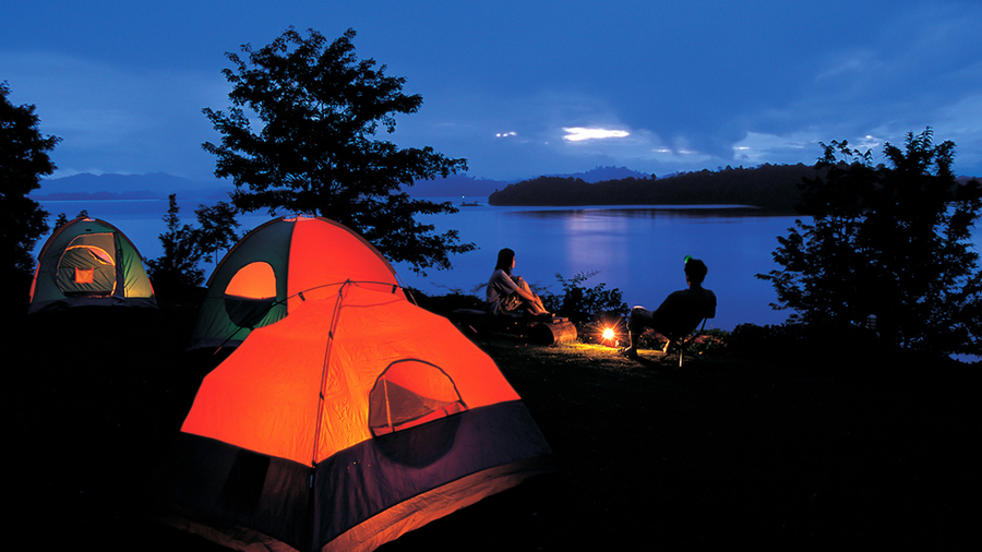
There are 41 campsites designated by the Agricultural, Fisheries and Conservation Department at country parks across Hong Kong, such as the Lau Shui Heung Campsite, the Lead Mine Pass Campsite and the Hok Tau Campsite. The Pui O Campsite and the Chong Hing Water Sports Centre are both located at Lantau Island and managed by the Leisure and Cultural Services Department. Other than these governmental campsites, there are some camping services and campsites provided by non-government organisations.Yet, camping sites designated by the authority are more preferable when you are planning for your camp. There are plenty of choices among these designated camping sites, get set and explore the nature fun now! Campsites managed by the Leisure and Cultural Services DepartmentPui O Campsite  Chong Hing Water Sports Centre    Campsites designated by the Agricultural, Fisheries and Conservation DepartmentLau Shui Heung Campsite       Lead Mine Pass CampsiteHok Tau Campsite       Rotary Club CampsiteChung Pui Campsite       Twisk CampsiteSam A Chung Campsite       Ho Pui CampsiteTung Ping Chau Campsite       Tin Fu Tsai CampsiteWan Tsai South Campsite       Nam Shan CampsiteWan Tsai West Campsite       Pak Fu Tin CampsiteCheung Sheung Campsite       Shap Long CampsiteHau Tong Kai Campsite       Lo Kei Wan CampsiteTai Tan Campsite       Shek Lam Chau CampsiteWong Shek Campsite       Tai Long Wan CampsitePak Tam Au Campsite       Kau Ling Chung CampsiteSai Wan Campsite       Man Cheung Po CampsiteLong Ke Wan Campsite       Nga Ying Kok CampsitePak Lap Campsite       Tsin Yue Wan CampsiteYuen Ng Fan (Nam Fung Wan) Campsite       Ngong Ping Campsite (Lantau)Po Kwu Wan Campsite       Kong Ha Au CampsiteYee Ting Campsite       Shek Pik CampsiteShui Long Wo Campsite       Ham Tin Wan CampsiteNgong Ping Campsite (Ma On Shan)       Tai Mong Tsai CampsiteTung Lung Chau Campsite        *Due to extremely low precipitation in the last twelve months, water supply is becoming a problem at many campsites. Campers may need to bring along water for drinking and cooking purposes. Please check before you plan a camp. And please refer to "Camping Code and Regulations". Other non-government organisations providing tent camping servicesHong Kong Girl Guides Association Pok Hong Campsite    Scout Association of Hong Kong Shatin Scout Centre    Scout Association of Hong Kong Gilwell CampsiteScout Association of Hong Kong Choi Chee Ming Luen Kwong Scout CentreHong Kong Playground Association Tung Chung Outdoor Recreation Camp   YMCA of Hong Kong Lamma Island Outdoor Centre   Tung Wah Group of Hospitals Ma Tso Lung Campsite    Camps/Centres of subvented non-government organisations Chinese YMCA of Hong Kong Y's Men-YMCA Wong Yi Chau Youth Camp Hong Kong Playground Association Silvermine Bay Outdoor Recreation Camp    Scout Association of Hong Kong Tai Tam Scout Centre    Scout Association of Hong Kong Tung Tsz Scout Centre    Scout Association of Hong Kong Pak Sha Wan Tam Wah Ching Sea Activities Centre   For more details, please refer to the AFCD website or LCSD website

[Our hiking friends. AFCD fire crew]

This story is only available in Chinese. For more information on the subject, please visit the Facebook page of Agriculture, Fisheries and Conservation Department.

[My workplace is in Lau Shui Heung Reservoir]

This story is only available in Chinese. For more information on the subject, please visit the Facebook page of Hong Kong Country Parks.

Hiking skills that you need to know

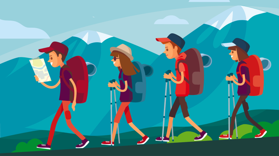
Hiking is a physical activity with both physical and mental benefits. It can improve your physical fitness and help you relax. You may need many different skills for any particular sport, and each sport, including hiking, has its unique skills. If you can master the skills of hiking, you can diminish energy loss and minimise the chance of getting hurt. Here are some hiking tips by Enjoy Hiking:  Uphill Maintain a natural pace and avoid making very large strides. Avoid climbing at high speed. Don't rest too frequently or for too long. When you feel tired, slow down instead of stopping. Tread only on secure stable ground, where there is enough foot room. Use the strength of your legs to climb. Avoid pulling yourself up by grasping small trees or branches, as they may break leading to a fall. Keep your upper body straight. When going up very steep slopes, don't go straight ahead. Move sideways and work your up in a series of zigzags.   Downhill Never run downhill ―this is a certain way to have a dangerous fall. Tread only on secure stable ground, with enough foot room. Avoid treading on wet slippery ground, especially wet clay or grasses. But if there is no other way, proceed with caution and keep your body low. Use the strength of your legs to descend. Avoid sliding down by grasping small trees or branches. This indicates you are half out of control. Branches can break and, even if they don't, you will damage the vegetation. Keep your upper body straight. When moving down very steep slopes, move sideways and work down in a series of zigzags.   Food and Drink Never eat or drink while moving. Relax to take refreshments. Don't hurry with your food or drink. Never drink untreated water from hill streams or eat any wild plants or mushrooms. Don't consume icy drinks immediately after a long hike, when your body temperature is still high. Never drink alcohol during a hike.   Foot Care Wear suitable hiking shoes. Wear new shoes on level ground a few times before going on a serious hike. This will ensure the surface material is soft and the shoes are comfortably worn in to the shape of your feet. Bootlaces should not be too tight. Wear two pairs of socks made of soft, fluffy and absorbent material. Trim your toenails, and try to keep your feet clean and dry. Stop walking if your feet are uncomfortable. Inspect them and treat any wounds promptly. If there are signs of blisters, put a plaster on the affected area. Blisters should be dressed with an absorbent plaster that eliminates moisture. Serious blisters should be treated with antiseptic. Pierce the blisters with a sterile pin and squeeze out any moisture. Avoid touching the wounds directly, and cover them with an antiseptic dressing right away. For soreness or cramps in the legs, massage the leg muscles. If possible, soak feet in warm water, or use a menthol-based heat rub ointment.   Moreover, to be well prepared for your next hiking trip, you may check out the following website for more information. A Guide for Hikers (Centre for Health Protection) Safety Hints on Hiking (Hiking Scheme)  Source: AFCD Enjoy Hiking website

Hong Kong Hiking Challenge Checkpoints (Islands District)

From September to December this year, the Agriculture, Fisheries and Conservation Department organises the Hong Kong Hiking Challenge to encourage nature lovers and hikers to set off for the countryside and take on the challenge! Go outside and hike through the country parks, immerse yourself in the spectacular views and learn more about the unique stories of Hong Kong’s local flora and fauna, and discover the beauty of undulating mountain ridges. There are 25 checkpoints scattered in various scenic spots in the country parks, featuring a variety of picturesque views unique to Hong Kong’s countryside. Participants can plan their own routes to visit these checkpoints based on their interest, physical fitness and hiking experience. Use a smartphone to check in at the checkpoints to collect the unique local flora and fauna badges made for each checkpoint. You will also learn about the amazing biodiversity of Hong Kong! Collect a certain number of badges and you will get different rewards! Let the challenge begins! Here are the 3 checkpoints in Islands District:   [ Checkpoint 1: Lo Fu Tau Viewing Point ] Location: Lantau North (Ext.) Country Park | Difficulty: ★★★Trail: Lo Fu Tau Country Trail Lo Fu Tau Sword Testing Stone | Open location on map There are two viewpoints at the top of Lo Fu Tau that offer very different views, one faces north towards the airport and Tuen Mun, and the other faces south towards Discovery Bay Reservoir and the golf course. The rolling mountain ranges, with strange rocks protruding here and there, are like a beautiful landscape painting. In autumn, the silvergrass and other wild grasses on the hills turn golden, like a tiger's dazzling fur. [ Checkpoint 2: Lantau Trail Section 2 ] Location: Lantau South Country Park | Difficulty: ★★★Trail: Silvergrass on Sunset Peak and Stone Chalets Lantau Trail (Section 2) Nam Shan to Pak Kung Au South Lantau Country Trail | Open location on map The third highest mountain in Hong Kong, Sunset Peak offers spectacular views of South Lantau. The mountain is undoubtedly the most popular attraction of late autumn, as visitors flock to capture its glistening cape of silvergrass in the slanting sun. Away from the lights of the city, the mountain brings you closer to the infinite sky, feast your eyes on the ever-changing views of sunrise and sunset and immerse in nature as the sea of clouds floats towards and over you. [ Checkpoint 3: Nei Nak Shan Country Trail ] Location: Lantau North Country Park | Difficulty: ★★Trail: Nei Lak Shan Country Trail | Open location on map Nei Lak Shan Country Trail offers varied views of Tung Chung City to the east and the flying chessboard of the airport to the north. In spring and summer, the hills are encompassed in fog, while in autumn and winter, the blanket of silvergrass is in full bloom. The route overlaps midway with the cable car ropeway, providing opportunities to photograph cable cars zooming overhead. At dusk, the spectacular view of Ngong Ping Village and the Big Buddha is enhanced with the setting sun in the background. For more about the Hong Kong Hiking Challenge event, please visit the "Hong Kong Hiking Challenge" website. (The images and the information are provided by the Agriculture, Fisheries and Conservation Department)

Hong Kong Hiking Challenge Checkpoints (Hong Kong Island)

From September to December this year, the Agriculture, Fisheries and Conservation Department organises the Hong Kong Hiking Challenge to encourage nature lovers and hikers to set off for the countryside and take on the challenge! Go outside and hike through the country parks, immerse yourself in the spectacular views and learn more about the unique stories of Hong Kong’s local flora and fauna, and discover the beauty of undulating mountain ridges. There are 25 checkpoints scattered in various scenic spots in the country parks, featuring a variety of picturesque views unique to Hong Kong’s countryside. Participants can plan their own routes to visit these checkpoints based on their interest, physical fitness and hiking experience. Use a smartphone to check in at the checkpoints to collect the unique local flora and fauna badges made for each checkpoint. You will also learn about the amazing biodiversity of Hong Kong! Collect a certain number of badges and you will get different rewards! Let the challenge begin! Here are the 7 checkpoints on Hong Kong Island:   [ Checkpoint 1: Dragon's Back Viewing Point ] Location: Shek O Country Park | Difficulty: ★★ Trail: Hong Kong Trail (Section 8) To Tei Wan to Tai Long Wan | Open location on map The ridge of Shek O Peak to Wan Cham Shan undulates like a giant dragon, hence the name "Dragon's Back". The viewing point at the highest point offers a panoramic view of Shek O, Tung Lung Island, Stanley and Tai Tam. Strolling along the shady paths along the hillside of Wan Cham Shan, drown yourself in the music of rustling trees and chirping birds as you embrace nature's tranquillity and comfort. [ Checkpoint 2: Tai Tam Byewash Reservoir ] Location: Tai Tam Country Park | Difficulty: ★Trail: Tai Tam Tuk Reservoir Masonry Bridge | Open location on map The Tai Tam Reservoir Group is home to over 20 declared monuments including the upper reservoir's dam, masonry bridge and aqueduct, the byewash reservoir dam and valve house and Tai Tam Tuk Reservoir masonry bridge. The paths around the reservoirs form easy walks with breathtaking views between these special reservoirs, the landscape and the unique stone bridges and historic buildings. [ Checkpoint 3: Mount Butler Viewing Point ] Location: Tai Tam Country Park | Difficulty: ★★★Trail: Hong Kong Trail (Section 5) Wong Nai Chung Gap to Mount Parker Road | Open location on map Mount Butler Viewing Point is located in the centre of Hong Kong Island. Hikers along this route will climb Jardine's Lookout and Mount Butler back-to-back. With both mountains peaking at over 400 metres, Jardine's Lookout offers a view from Victoria Harbour to the bustling commercial area of Kowloon Peninsula. Mount Butler is reportedly the best viewing point on Hong Kong Island as it overlooks Lamma Island, the Tai Tam Reservoir Group, Stanley and the southern part of Hong Kong Island. [ Checkpoint 4: Sir Cecil's Ride Viewing Point ] Location: Tai Tam (Quarry Bay Ext.) Country Park |Difficulty: ★★ Trail: Tai Tam Country Park and Tai Tam Country Park (Quarry Bay Extension) | Open location on map The 17th Governor of Hong Kong, Sir Cecil Clementi, was said to have been a frequent equestrian on this route, which was then named after him. This trail overlaps with the 2-kilometre Quarry Bay Jogging Trail, which connects Mount Parker Road in the south to Choi Sai Woo of North Point in the north. The viewpoint near the northern start of the jogging trail offers panoramic views of the eastern part of Hong Kong and Kowloon, showcasing Victoria Harbour from Tsim Sha Tsui to Lei Yue Mun. [ Checkpoint 5:  Middle Gap Viewing Point ] Location: Aberdeen Country Park | Difficulty: ★★Trail: Hong Kong Trail (Section 4) Wan Chai Gap to Wong Nai Chung GapTai Hang Tun Kite-Flying Area | Open location on map Middle Gap is located in the centre of Hong Kong Island between Mount Cameron and Mount Nicholson, with Wanchai Gap to the west and Wong Nai Chung Gap to the east. Given its moderate elevation, the viewpoint still offers an amazing bird's eye view sweeping from the west to south, over Nam Long Shan, Ocean Park, Shouson Hill, Repulse Bay and Chung Hom Shan, as well as the small islands of Ngan Chau and Middle Island. [ Checkpoint 6: Mount High West Viewing Point ] Location: Pok Fu Lam Country Park | Difficulty: ★★★Trail: High West Viewing Point | Open location on map The fourth highest peak on Hong Kong Island, Mount High West separates the bustle of the Central and Western District from the tranquillity of the Southern District. After climbing more than 600 steps, you will reach the unobstructed peak and enjoy a panoramic view of the sea and sky of the West Lamma Channel. Near dusk, as the sun slowly descends behind the mountain ranges of Lantau Island, the sky, the sea and the Victoria Harbour are illuminated in a fiery red, while skyscrapers on both sides of the harbour glow in gold slowly transform into night lights. [ Checkinpoint 7: Lung Fu Shan Viewing Point ] Location: Lung Fu Shan Country Park | Difficulty: ★★Trail: Observation Post at High West Pinewood Battery Heritage Trail Pinewood Battery | Open location on map Lung Fu Shan Country Park is the smallest country park in Hong Kong, with Victoria Peak to the east, Mount High West to the south, Shek Tong Tsui to the north and Mount Davis to the west. Despite being petite, this country park is a conglomeration of rich natural ecology and historic backgrounds, including the renowned relics of Pinewood Battery. Lung Fu Shan Viewing Point was once an artillery observation post, but today the smoke and fumes are gone and only the setting sun remains, allowing visitors to enjoy the view of the western side of Hong Kong Island. For more about the Hong Kong Hiking Challenge event, please visit the "Hong Kong Hiking Challenge" website. (The images and the information are provided by the Agriculture, Fisheries and Conservation Department)

Hong Kong Hiking Challenge Checkpoints (Kowloon and the New Territories)

From September to December this year, the Agriculture, Fisheries and Conservation Department organises the Hong Kong Hiking Challenge to encourage nature lovers and hikers to set off for the countryside and take on the challenge! Go outside and hike through the country parks, immerse yourself in the spectacular views and learn more about the unique stories of Hong Kong’s local flora and fauna, and discover the beauty of undulating mountain ridges. There are 25 checkpoints scattered in various scenic spots in the country parks, featuring a variety of picturesque views unique to Hong Kong’s countryside. Participants can plan their own routes to visit these checkpoints based on their interest, physical fitness and hiking experience. Use a smartphone to check in at the checkpoints to collect the unique local flora and fauna badges made for each checkpoint. You will also learn about the amazing biodiversity of Hong Kong! Collect a certain number of badges and you will get different rewards! Let the challenge begin!   Here are the 15 checkpoints in Kowloon and the New Territories:   [ Checkpoint 1: Hong Kong Reunification Pavilion (Kowloon Pass) ] Location: Lion Rock Country Park | Difficulty: ★★ Trail: MacLehose Trail (Section 5) Tate's Cairn to Tai Po Road | Open location on map The Hong Kong Reunification Pavilion was built in 1997 to commemorate Hong Kong's reunification with the Motherland, and it bears the inscription of the Chief Executive of Hong Kong, Tung Chee-hwa. From the pavilion, you can enjoy the cityscape of Kowloon in a myriad of lights and the Victoria Harbour. With the bustling city just beneath you, and mountains stretching out behind you, this combination weaves into a picturesque landscape second to none. [ Checkpoint 2: Biu Tsim Kok ] Location: Sai Kung East Country Park | Difficulty: ★Trail: Biu Tsim Kok - Viewing Points | Open location on map "Biu Tsim Kok" is a headland to the north of the High Island Reservoir East Dam. The hills are composed of volcanic hexagonal rock columns, creating a spectacular geological collage. This is one of the few places where you can see the hexagonal volcanic pillars from above, making it a popular spot for visitors to 'check in'. [ Checkpoint 3:Kiu Tsui Viewing Point ] Location: Kiu Tsui Country Park | Difficulty: ★ Trail: Sharp Island Geo Trail|Enjoy Hiking - Sharp Island - Waterscapes  Sharp Island Country Trail | Open location on map Sharp Island located in Port Shelter, Sai Kung, hosts a Geo Trail and a Country Trail. At high tide, Sharp Island and Kiu Tau are two islands; at low tide, a tombolo connecting the two islands is exposed, allowing visitors to access the islands on foot. The island's trails also offer a great view from Kiu Tsui Viewing Point to the east over the vast grasslands of Kau Sai Chau and Yim Tin Tsai area, or to the west over the tombolo. [ Checkpoint 4: Kei Ling Ha Coast (near Yung Shue O)  ] Location: Sai Kung West Country Park |Difficulty: ★ Trail: Cheung Sheung Country Trail | Open location on map Yung Shue O is located in the inner bay of Three Fathoms Cove, a calm bay full of fishing rafts. Three Fathoms Cove is surrounded by mountains, with the villages of San Wai and Lo Wai built along its shoreline, and huts scattered around the hillside, giving off a fishing village vibe. Nearby is the Cheung Sheung Country Trail; Cheung Sheung is a wetland on a highland surrounded by mountains. [ Checkpoint 5: Tai Hang Tun Kite Flying Area Viewing Point ] Location: Clear Water Bay Country Park | Difficulty: ★ Trail: Lung Ha Wan Country Trail Tai Hang Tun Kite-Flying Area | Open location on map The lush green hillside near Tai Hang Tun is Hong Kong's most open and scenic kite-flying site, offering a panoramic view of Hong Kong's south-eastern waters, from the Ninepin Group, Green Island, Tung Lung Chau, to Wang Lang Island, Beaufort Island and other islands in the south. Located on the eastern side of Hong Kong, far from the city's light pollution, the Kite Flying Area is ideal for star and moon gazing at night. At Tai Hang Tun, anyone, from children to grown-ups, can discover a unique and enjoyable countryside experience. [ Checkpoint 6: Kowloon Peak Viewing Point ] Location: Ma On Shan Country Park | Difficulty: ★ Trail: Sunset at Kowloon Peak Wilson Trail (Section 4) Tseng Lan Shue to Shatin Pass Road | Open location on mapFrom Kowloon Peak Viewing Point, you can enjoy the proximate view of Kowloon Peninsula, and on a clear day, even the view on both sides of the Victoria Harbour is clearly visible. As the sun sets and the sky blazes with different shades of orange-red with ever-changing clouds, the city lights up as if it is hustling for the next round of festivities. The splendid scene dotted with vivid colours is definitely a sight to behold. [ Checkpoint 7: Beacon Hill Viewing Point ] Location: Lion Rock Country Park | Difficulty: ★★Trail: MacLehose Trail (Section 5) Tate's Cairn to Tai Po Road | Open location on map Beacon Hill, named after the pen rest it resembles from a distance, offers a breath-taking view of the entire Kowloon Peninsula that even stretches to as far as Tseung Kwan O and Chai Wan. At sunset, you can fully take in the views of the blinking lights of the dynamic and vibrant city while basking in the warm rays of the receding sun. [ Checkpoint 8: Kowloon Reservoir ] Location: Kam Shan Country Park |Difficulty: ★ Trail: MacLehose Trail (Section 6) Tai Po Road to Shing Mun Kam Shan Tree Walk Kam Shan Family Walk | Open location on map A walk through Kam Shan Country Park brings the view of all four reservoirs of the Kowloon Reservoir Group– Kowloon Reservoir, Kowloon Secondary Reservoir, Kowloon Receiving Reservoir and Shek Lei Pui Reservoir. Attention often falls on Kowloon Reservoir, with its famous arched main dam, the valve house and the overflow dam, all of which are declared monuments. Take a break from the hustle and bustle of the city while you immerse in the calmness of the vast reservoir and the reflection of the sky. [ Checkpoint 9: Shing Mun Leisure Deck ] Location: Shing Mun Country Park | Difficulty: ★ Trail:  Shing Mun Leisure Deck | Open location on map Shing Mun Leisure Deck is a viewing point located on the eastern slope of Shing Mun Reservoir surrounded by the Reservoir and lush green mountains. When the water level is high in the reservoir, the Paperbark plantation is reflected everywhere, curating a poetic landscape of a picturesque mix of mountains and trees. [ Checkpoint 10: Tai Mo Shan Country Park Viewing Point (North) ] Location: Tai Mo Shan Country Park | Difficulty: ★★ Trail: Silvergrass on Tai Mo Shan  MacLehose Trail (Section 8) Lead Mine Pass to Route Twisk | Open location on map Tai Mo Shan is Hong Kong's highest peak, serving a 180-degree view of the Kam Tin plain from the northern viewing point. From high above, you can see as far as Lam Tsuen, Kai Kung Leng, Tai To Yan, and even Shenzhen. Tai Mo Shan offers different seasonal specials: in summer, the setting sun falls over Kam Tin plain at Pat Heung, colouring the distant Lau Fau Shan orange; in autumn and winter, the silvergrass dancing in the strong winds is common at this height. Looking back down from the peak, the view of the meandering road is a unique landmark of Tai Mo Shan. [ Checkpoint 10: Tai Mo Shan Country Park Viewing Point (North) ] [ Checkpoint 11: MacLehose Trail Section 9 Viewing Point ] Location: Tai Lam Country Park | Difficulty: ★ Trail: MacLehose Trail (Section 9) Route Twisk to Tin Fu Tsai | Open location on map This viewing point offers a panoramic view of Tsuen Wan, Rambler Channel and Stonecutters Island. Look further and observe countless ships busy scuttling within Victoria Harbour. Turn your sight to the container terminals, decorated by rainbow-coloured containers stacked up like a neat map of building bricks. [ Checkpoint 12: Reservoir Islands Viewpoint ] Location: Tai Lam Country Park | Difficulty: ★Trail: MacLehose Trail (Section 10) Tin Fu Tsai to Tuen Mun | Open location on map The Tai Lam Chung Reservoir, also known as Thousand-Island Lake, was completed in 1957 as the first reservoir built in Hong Kong after the Second World War. Located in an undulating river valley, the sight of islands of various sizes magically materialised after the area was flooded with water stored. The islands are vegetated with Chinese Red Pine, Slash Pine, Swamp Mahogany and Lemon-scented Gum, creating a lush green landscape on Thousand-Island Lake. [ Checkpoint 13: Lai Chi Wo Siu Ying Story Room ] Location: Plover Cove Country Park | Difficulty: ★ Trail: Lai Chi Wo  Lai Chi Wo Nature Trail | Open location on map The ancient Hakka village of Lai Chi Wo has a history of over 400 years; it is named after lychee which was once produced in abundance. The village has retained its traditional Hakka character in many aspects. With over 100 years of history, the village's ancestral hall, the Hip Tin Temple and the Hok Shan Monastery are listed as Grade III historic buildings. A trip to Lai Chi Wo sends you back in time to the old days of Hong Kong for a deep sense of the unique traditional Hakka culture. [ Checkpoint 14: Cloudy Hill ] Location: Pat Sin Leng Country Park | Difficulty: ★★★ Trail: Wilson Trail (Section 8) Yuen Tun Ha to Cloudy Hill  Wilson Trail (Section 9) Cloudy Hill to Pat Sin Leng | Open location on map Surrounded by serene valleys and lush green hillsides, Cloudy Hill is located at the junction of Sections 8 and 9 of the Wilson Trail. Atop its undulating ridge, breath-taking views of Tai Po City and Tolo Harbour unravel beneath you, immerse in this mountain paradise as a quick getaway from the repetitive city life. [ Checkpoint 15: Pak Tai To Yan Pavilion ] Location: Lam Tsuen Country Park |Difficulty: ★★★ Open location on map Tai To Yan literally means “large knife edge” in Chinese; from far, the mountain ridge resembles a knife blade resting on its spine with the edge pointing towards the sky. A narrow walkway lines the ridge sandwiched by near-vertical slopes on both sides. On top of the physical challenge, on a windy day, the hike might call for more willpower as you manoeuvre along the knife's edge. Take a break on the flat grass field and adjust the rhythm of your breath and your body before climbing the summit. For more about the Hong Kong Hiking Challenge event, please visit the "Hong Kong Hiking Challenge" website. (The images and the information are provided by the Agriculture, Fisheries and Conservation Department)

Associate Veterinary Technologist

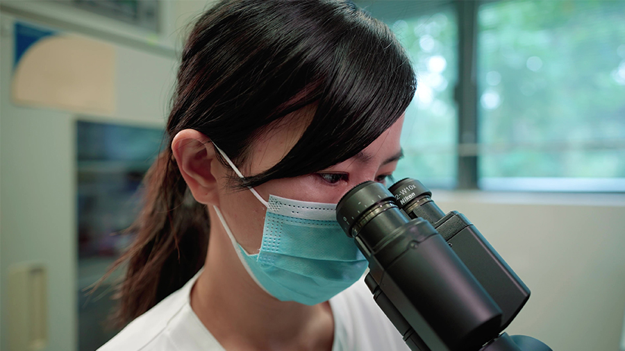
"I decided to study medical laboratory science because I wish to join laboratory related industries. In order to make use of the knowledge and skills I have learnt, in my work and to be a professional medical laboratory technologist. As a result, I got my wish and became an Associate Veterinary Technologist of the Agriculture, Fisheries and Conservation Department, contributing to safeguarding the health of humans and animals." Mike, Associate Veterinary Technologist of the Agriculture, Fisheries and Conservation Department."This job gives me a sense of mission. It is very stable and the salary is comparatively attractive. After joining the department, I felt that colleagues get along very well, and the supervisors are  very friendly. There are scenic views and fresh air here which increase your pleasant feelings at work." Yuki, Associate Veterinary Technologist of the Agriculture, Fisheries and Conservation Department.Please watch our video to find out more information about the work of Associate Veterinary Technologist of the Agriculture, Fisheries and Conservation Department and its career prospect. Organisation chartOfficial recruitment page

[Challenging!] Hiking Routes Recommendations (Difficulty: 4 to 5 stars ★★★★★)

It’s time for a hike as autumn approaches! For hikers who are seeking further challenges, you may visit the “4-star to 5-star” hiking routes recommended by the dedicated website “Enjoy Hiking” of the Agriculture, Fisheries and Conservation Department and “Difficult” routes recommended by “Hiking Scheme” website of the Leisure and Cultural Services Department. Choose your preferred route and plan a hike with friends and family members! (★=Easy | ★★=Moderate | ★★★=Demanding | ★★★★=Difficult | ★★★★★=Very Difficult)     *Please choose>>> Hong Kong Island North New Territories West New Territories Central New Territories Sai Kung Lantau Jardine’s Lookout - Quarry Bay(Difficulty: ★★★★)Start at Mount Butler Road, walk along Sir Cecil’s Ride and proceed to Tai Tam Reservoir Road, Jardine’s Lookout and Siu Ma Shan. Continue along Quarry Bay Tree Walk to Greig Road, Quarry Bay. This route largely follows Section 2 of the Wilson Trail⋯⋯Read moreTo Tei Wan - Big Wave Bay (Difficulty: ★★★★)Start at To Tei Wan, Shek O Road, and walk uphill to Shek O Peak.  Then walk along the ridge between the peak and Wan Cham Shan, which resembles the back of a dragon and is well known as Dragon’s Back (Lung Chek).  Though a bit steep on both sides, the ridge offers stunning sea views on the east and west coasts and magnificent scenery along the path⋯⋯Read more (Back to Top) Wilson Trail (Section 8) Yuen Tun Ha to Cloudy Hill (Difficulty: ★★★★)Section 8 does not fall within the area of country parks and it starts at Sheung Wun Yiu, San Uk Ka. From there to King Law Ka Shuk, Tai Po Tau Tsuen, it is a cultural tour – as early as the Ming dynasty, the hills were once a kiln site because of its abundant water resources from Tai Mo Shan and rich deposits of porcelain clay in the soil⋯⋯Read more Wilson Trail (Section 9) Cloudy Hill to Pat Sin Leng (Difficulty: ★★★★)Section 9 starts from the summit of Cloudy Hill and ends at Hsien Ku Fung, traversing Hok Tau Reservoir, Ping Fung Shan, and Pat Sin Leng. Immersed in the peace and tranquility of the landscape at Hok Tau Reservoir before you take the footpath at the junction⋯⋯Read more Wilson Trail (Section 10) Pat Sin Leng to Nam Chung (Difficulty: ★★★★)The last section is a scenic route as well as an easy hike. After descending from Hsien Ku Fung, the stone stairs lead down to Pat Sin Leng Nature Trail. Along the trail, you will wend your way through the deserted ancient village of Wang Shan Keuk Ha Tsuen⋯⋯Read more Ma Mei Ha - Luk Keng (Difficulty: ★★★★)Ascend Ping Teng Au from Tan Chuk Hang, walk along Nam Chung Country Trail and head toward Nam Chung via Lo Lung Tin.  Take in the views of the north-eastern part of the New Territories and the boundary at Sha Tau Kok along the way⋯⋯Read more Wu Kau Tang - Luk Keng (Difficulty: ★★★★)Enter the ancient footpath of Lai Tau Shek from Wu Kau Tang and proceed to Lai Chi Wo.  On the way, visit the ancient temple and the Hakka village.  Take a close look of the old banyan, white-flowered derris, hollow tree, mangroves and the buttress roots of looking glass trees⋯⋯Read more Wu Tip Shan - Lam Tsuen (Difficulty: ★★★★)Start from the entrance to the cement-paved Wu Tip Shan Path and walk uphill. The route involves mainly uphill sections with hillside steps and downhill footpaths, so make sure you are physically fit for it. There is a viewing platform in the section between Wu Tip Shan and Kei Lak Tsai, where you can enjoy the magnificent scenery of New Territories North⋯⋯Read more Plover Cove Reservoir Country Trail (Difficulty: ★★★★★)Completed in 1968, Plover Cove Reservoir is the second largest reservoir in Hong Kong in terms of the area it covers.  The many undulating slopes and the lack of supplies on this long hiking trail that skirts around the reservoir make it a test of experience and fitness⋯⋯Read more (Back to Top) MacLehose Trail (Section 10) Tin Fu Tsai to Tuen Mun (Difficulty: ★★★★)The last section of the MacLehose Trail is the lengthiest one, crossing almost half of Tai Lam Country Park and extending to Tuen Mun Town. Kat Hing Bridge is at the intersection of streams and was once the main access connecting Yuen Long to Tsuen Wan. There used to be seven small crossing bridges⋯⋯Read moreYuen Tsuen Ancient Trail Country Trail (Difficulty: ★★★★)Ancient trails used to be a key route for villagers to communicate and do trade with the outside world in the old days.  Many of them, including Nam Hang Pai Ancient Trail, Kap Lung Ancient Trail, and Yuen Tsuen Ancient Trail, lie inside Tai Lam Country Park, which also has the greatest number of country trails.  Linking Yuen Long with Tsuen Wan⋯⋯Read more Tsuen King Circuit - Sham Tseng (Difficulty: ★★★★)Enter the Yuen Tsuen Ancient Trail from Pun Shan Tsuen in Chai Wan Kok and follow the path around Shek Lung Kung.  Cross Tin Tsing Bridge and walk past Tin Fu Tsai Campsite to reach Tsing Fai Tong.  Walk westward for about 1 km to a junction and continue down the path heading south to Sham Tseng Settlement Basin⋯⋯Read more Chuen Lung - Shing Mun Reservoir (Difficulty: ★★★★)Start at Chuen Lung minibus station at Route Twist. Upon reaching Choi Lung Restaurant, follow the driveway leading to Chuen Lung Management Centre. Continue along the Lung Mun Country Trail and proceed to the Shing Mun Forest Track (Reservoir Section). Take the path on the right leading to Pineapple Dam, where you may visit the Butterfly Paradise on the way. The trip ends at Shing Mun Road⋯⋯Read more Wong Nai Tun - Tai Tong (Difficulty: ★★★★)Visit Yeung Ka Tsuen Old House in Tai Tong, and the three ancient temples around Pak Fu Au.  Get spectacular views of the “Thousand-lsland Lake” in Tai Lam Chung Reservoir while walking along the MacLehose Trail in the reverse direction and enjoying the beautiful scenery on the way⋯⋯Read more (Back to Top) MacLehose Trail (Section 8) Lead Mine Pass to Route Twisk (Difficulty: ★★★★)Hong Kong used to have many mine sites, one of which was Lead Mine Pass. There were mining activities in the east of the present day Shing Mun Country Park in as early as the 1930s. The mine sites have gone derelict since the 1960s as a result of the emergence of a large number of overseas large-scale mine sites and the plummeting price of ore⋯⋯Read more (Back to Top) MacLehose Trail (Section 2) Long Ke to Pak Tam Au (Difficulty: ★★★★)MacLehose Trail Section 2 is one of the phenomenally popular hiking trails, and this is the best section for you to feel the beauty of the coast of Hong Kong.  At the start of MacLehose Trail Section 2 is the steep, 314-metre Sai Wan Shan; only after descending from this mountain can you reach Sai Wan beach, otherwise known as “the Maldives of Hong Kong”⋯⋯Read moreMacLehose Trail (Section 3) Pak Tam Au to Kei Ling Ha (Difficulty: ★★★★)Featuring undulating mountains with a steep gradient, the third section of the MacLehose Trail is definitely one of the top three in terms of difficulty. With the trail traversing Ngam Tau Shan, Wa Mei Shan, Lui Ta Shek and Kai Kun Shan, their dazzling heights at around 400 metres above sea level can offer you distinct appearances of the rolling mountains from different angles⋯⋯⋯Read moreMacLehose Trail (Section 4) Kei Ling Ha to Tate's Cairn (Difficulty: ★★★★)The fourth section of the MacLehose Trail is another gateway to even more breath-taking scenery, as the saying “Perfection knows no limits” goes. Go through Wong Chuk Yeung Village from Shui Long Wo, and then climb up to the 555-metre high Ma On Shan ridge. Although by no means an easy section, it commands Yim Tin Tsai and Kau Sai Chau from a height – the higher you are, the farther you can see⋯⋯Read moreTai Long Wan Hiking Trail (Difficulty: ★★★★)Starting at Sai Wan Pavilion, this immensely popular hiking trail first traverses Sai Wan and then Ham Tin Wan, both of which face the Pacific Ocean. It never ceases to amaze visitors with such landforms as streams and estuaries as well as turquoise water and fine sand⋯⋯⋯Read moreLau Shui Heung - Tai Po Tau (Difficulty: ★★★★)Start at Lau Shui Heung Reservoir and take the country trail on the right.  After passing Lau Shui Bridge, cross Lung Shan Bridge and walk through Kat Tsai Shan Au.  Walk slowly up Cloudy Hill (Kau Lung Hang Shan) located on the western boundary of Pat Sin Leng Country Park and enjoy a spectacular view of Tolo Harbour and Tai Po lying at the foot of the mountains in the north-eastern part of New Territories.  Continue along Section 8 of the Wilson Trail in the reverse direction to reach Tai Po Tau, where dining and entertainment options are conveniently available⋯⋯Read moreTai Au Mun - Hang Hau (Difficulty: ★★★★)Start at Tai Au Mun, walk slowly up the south-facing slope of High Junk Peak (Tiu Yue Yung), which is one of the three steepest climbs in Sai Kung with an elevation of 344 metres.  Carry on along the north side of the ridge toward Sheung Yeung Shan.  Visit Mang Kung Uk by the hillside and walk down the slope to Hang Hau, Tseung Kwan O through Wo Tong Gong⋯⋯Read moreUk Tau - Wong Shek - Hoi Ha (Difficulty: ★★★★)Visit the coastal mangroves at Uk Tau, Sai Kung before taking the Wong Shek Family Walk to Tai Tan.  Enter the Tai Tan Country Trail and enjoy the magnificent scenery of Tap Mun and Ko Lau Wan.  Follow the path around Lan Lo Au until you reach Hoi Ha Wan, visit the “Drumming Rock” and enjoy a spectacular view of Hoi Ha Wan⋯⋯⋯Read moreHau Tong Kai - Pak Tam Au (Difficulty: ★★★★)Walk into the tranquil woods from Hau Tong Kai, Sai Kung.  Climb slowly up the path leading to the mountain village Cheung Sheung and proceed to Au Mun to explore the views of Jacob’s Ladder, Yung Shue O Village and Kei Ling Ha Hoi.  In the afternoon, climb Ngau Yee Shek Shan (440m) and walk along Section 3 of the MacLehose Trail down to Pak Tam Au⋯⋯⋯Read moreChui Tung Au – Pak Tam Au (Difficulty: ★★★★)Start at Sai Wan Pavilion to Chui Tung Au and walk downhill to Sai Wan and Ham Tin Wan, where you can explore the beautiful beaches with powdery sand and clear water. Walk up to Tai Long Au and head toward Pak Tam Au via Chek Keng on the return leg. This is a rather long route with uphill and downhill sections offering splendid scenery but no breakaway points⋯⋯Read morePak Sha O - Shui Long Wo(Difficulty: ★★★★)Enter a concrete path after reaching the road sign for Pak Sha O on Hoi Ha Road. Walk to She Shek Au via Ha Yeung and Nam Shan Tung.  Go downhill, walk past an old church and proceed to Sham Chung, where you can enjoy a panoramic view of a vast area of grassland.  Walk along the coastal path which leads to Yung Shue O through an area of mangroves.  Then walk along the catchwatch to Shui Long Wo while taking in the wonderful sunset views over Three Fathoms Cove⋯⋯Read more Devil's Peak - Tseng Lan Shue (Difficulty: ★★★★)Start at W020 of Wilson Trail and walk slowly up to the relics on Devil’s Peak (Pau Toi Shan) (Note: the path leading to the wartime ruins is rather rugged).  Get a panoramic view of the eastern part of Hong Kong Island and Yau Tong.  Continue up the path to a morning walker garden on Black Hill (304m) and have a bird’s eye view of the much changed Tseung Kwan O⋯⋯⋯Read more (Back to Top) Chi Ma Wan Country Trail (Difficulty: ★★★★)Chi Ma Wan Country Trail, with a total length of 18.5 kilometres, starts and ends at Shap Long Campsite.  The trail almost circumnavigates Chi Ma Wan Peninsula, offering hikers vistas of Pui O Bay, Ham Tin Village and Cheung Sha⋯⋯Read more Lantau Trail (Section 2) Nam Shan to Pak Kung Au (Difficulty: ★★★★)Adorned with a seemingly limitless sea of silvergrass at an elevation of 869 metres and 749 metres respectively, Sunset Peak and Yi Tung Shan have not only been a paradise for hiking enthusiasts, but also a magnet for photography aficionados.  You can reach them by walking along the stone steps from the barbecue site at Nam Shan Au, the start point of Section Two of the Lantau Trail⋯⋯Read more Lantau Trail (Section 3) Pak Kung Au to Ngong Ping (Difficulty: ★★★★)Before Hong Kong became a city and a trading port, Lantau Peak had always been referred to as ‘Lan Tau’, which is the romanisation of the words ‘broken head’ in Chinese, by local villagers because the outline of its summit looks broken apart.  In the 19th century when the British came to Hong Kong, the whole island was called the same name; this is how Lantau Island got its name⋯⋯Read more (Back to Top) (The information are provided by Agriculture, Fisheries and Conservation Department and Leisure and Cultural Services Department)

[Starters] Hiking Routes Recommendations (Difficulty: 1 star★)

It’s time for a hike as autumn approaches! For elementary level hikers, you may visit the “1-star” hiking routes recommended by the dedicated website “Enjoy Hiking” of the Agriculture, Fisheries and Conservation Department and “easy” routes recommended by the “Hiking Scheme” website of the Leisure and Cultural Services Department. Choose your preferred route and plan a hike with friends and family members! (★=Easy | ★★=Moderate | ★★★=Demanding | ★★★★=Difficult | ★★★★★=Very Difficult)     *Please choose>>> Hong Kong Island North New Territories West New Territories Central New Territories Sai Kung Lantau Aberdeen Nature Trail (Difficulty: ★)The first leg of Aberdeen Nature Trail skirts along Lower Aberdeen Reservoir on a level path. Once privately owned by a papermill, the reservoir was surrendered to the government⋯⋯Read moreAberdeen Tree Walk (Difficulty: ★)Aberdeen Tree Walk lies near the urban area and takes about 10 minutes' walk from Aberdeen's downtown area. To nearby residents, the green haven is a cherished “Backyard Garden of Hong Kong Island⋯⋯Read more Pinewood Battery Heritage Trail (Difficulty: ★)Located inside Lung Fu Shan Country Park, the Pinewood Battery Heritage Trail features some batteries that have been standing for as many as a hundred years within a span of 400 metres⋯⋯Read morePok Fu Lam Family Walk (Difficulty: ★)How far is the countryside from the city? In the case of Pok Fu Lam Family Walk, the only family walk on Hong Kong Island, it is only a 5-minute walk away. Although undulating⋯⋯Read morePok Fu Lam Tree Walk (Difficulty: ★)Pok Fu Lam Tree Walk is the first Hong Kong tree walk featuring native plant species. This route winds along Lugard Road by the Peak Galleria. While admiring the beauty of nature⋯⋯Read moreQuarry Bay Tree Walk (Difficulty: ★)Quarry Bay Tree Walk is a comfortable and peaceful route, connecting Mount Parker Road and Kornhill Garden. It also overlaps with Stage 2 of Wilson Trail and part of the Eastern Na⋯⋯Read more Wong Nai Chung Tree Walk (Difficulty: ★)Wong Nai Chung Tree Walk is in essence the sections of Sir Cecil’s Ride between Wong Nai Chung Gap Road and Mount Butler. The Tree Walk is 2.2km in length, flat and smooth, and it takes about one hour to complete⋯⋯Read more Tai Tam Family Walk (Difficulty: ★)Hiking trails in Hong Kong are oases of serenity in the urban jungle. Among them is Tai Tam Family Walk, one of the best places to get away from the hustle and bustle of city life. The family walk is easily accessible by public transport⋯⋯Read moreTai Tam Tree Walk (Difficulty: ★)Tai Tam Tree Walk, about 70m in length, is the shortest tree walk in Hong Kong’s country parks. With 12 information plates installed along the Tree Walk introducing trees including⋯⋯Read more Pok Fu Lam Reservoir - Hong Kong University (Difficulty: ★)Start at Pok Fu Lam Reservoir Road and walk along the Peak Trail in a reverse direction.  Enter Lugard Road at the Peak to take in the spectacular views of Victoria Harbour on the path skirting around the Peak⋯⋯Read more (Back to Top) Ap Chau Geosite (Difficulty: ★)Located to the east of Sha Tau Kok, Ap Chau, which literally means ‘duck island’, got its name because it looks like a duck on water. Composed of red breccia, which is rare in Hong Kong⋯⋯Read moreBride's Pool Nature Trail (Difficulty: ★)Located at the northwestern corner of Plover Cove Country Park, Bride’s Pool Nature Trail meanders along the valley and skirts along cascades. The trail is easy to walk⋯⋯Read more Chung Pui Tree Walk (Difficulty: ★)Chung Pui Tree Walk is a circular route 0.25km in length, spanning along Brides’ Pool Road. Fourteen species of trees are introduced along the Tree Walk⋯⋯Read more Fung Hang Family Walk (Difficulty: ★)Visitors are a rarity in many border regions, but it is these areas that provide a habitat for a wealth of wildlife. The same is true of Hong Kong. During spring and summer, Sha Tau Kok Hoi, in which the famous egretry in A Chau is situated⋯⋯Read more Hok Tau Reservoir Family Walk (Difficulty: ★)Located inside Pat Sin Leng Country Park, Hok Tau Reservoir was once an area of streams and marshes with abundant water supply. Therefore an irrigation reservoir was built there in 1968⋯⋯Read more Lai Chi Wo Nature Trail (Difficulty: ★)Located in the Double Haven Geo-Area, Lai Chi Wo Nature Trail passes through an old Hakka village. It is the best place to get close to wildlife in Lai Chi Wo, and explore Hakka culture and history⋯⋯Read more Tai Mei Tuk Family Walk (Difficulty: ★)Tai Mei Tuk is located on a promontory of Plover Cove, which is encircled on three sides by mountains. In the 1960s the then Director of Water Supplies Department T.O. Morgan proposed linking Pak Sha Tau and Tai Mei Tuk with a 2-kilometre dam to cut off the cove from the sea⋯⋯Read more Ma Shi Chau Nature Trail (Difficulty: ★)Ma Shi Chau Nature Trail is located in the Ma Shi Chau Special Area, which is fairly close to Yim Tin Tsai. Formed as a result of deposition of fine particles that gradually turn into sandspits, a tombolo emerges⋯⋯Read more Lok Ma Chau - Ho Sheung Heung (Difficulty: ★)Start at Lok Ma Chau Path and proceed to Lok Ma Chau Garden.  There is a viewing platform in the garden, where you can overlook the vast area of fish ponds near Shenzhen River.  Then take the concrete path leading to the villages which have been excluded from the closed area since 2013⋯⋯Read more (Back to Top) Chuen Lung Family Walk (Difficulty: ★)Situated on a hill in Tsuen Wan, Chuen Lung is an ancient Hakka village, as well as a resting place for hikers to enjoy Dim Sum⋯⋯Read more Ho Pui Reservoir Family Walk (Difficulty: ★)Located inside Tai Lam Country Park, Ho Pui Reservoir is an irrigation reservoir in Pat Heung, Yuen Long that feeds the fields in northwest New Territories. Compared to other large reservoirs, Ho Pui Reservoir bears a closer resemblance to a small lake in the woods⋯⋯Read more Rotary Park Nature Trail (Difficulty: ★)The Rotary Park Nature Trail is the perfect place for children to get close to nature. With barbecue sites at the start point, the trail is easily accessible and suitable for families⋯⋯Read more Tai Tong Tree Walk (Difficulty: ★)Adjacent to Tai Tong BBQ Site No.1 in Tai Lam Country Park, Tai Tong Tree Walk is only 650m in length with 9 information plates erected⋯⋯Read more Twisk Nature Trail (Difficulty: ★)If you look at photos taken in the 19th century, you will discover that mountains in Hong Kong were not covered in the lush green vegetation we see today. In fact, the government started large scale afforestation work only after the Second World War⋯⋯Read more Tai Mo Shan Family Walk (Difficulty: ★)Located inside Rotary Park, Tai Mo Shan Family Walk is a circular walk that skirts along a forest. The stone-paved path is easy and short, taking no more than half an hour to finish⋯⋯Read more Tuen Mun-Lam Tei Reservoir - Miu Fat Buddhist Monastery (Difficulty: ★)Start at Wah Fat Playground, climb up the stone steps and continue along Tuen Mun Fitness Trail (Section 10 of the MacLehose Trail).  Then make a turn to Tuen Mun Trail. Proceed to Lam Tei Reservoir via Fu Tei.  This gentle half earth half concrete path offers an open view⋯⋯Read more (Back to Top) Eagle's Nest Nature Trail (Difficulty: ★)Eagle’s Nest, also known as Tsim Shan, is located inside Lion Rock Country Park and is near Shek Lei Pui Reservoir. On Eagle’s Nest, black kites, raptors commonly seen⋯⋯Read more Hung Mui Kuk Nature Trail (Difficulty: ★)Between spring and summer, visitors to Hung Mui Kuk are bound to fall into a fanciful reverie when strawberry trees scatter all over the mountain and the valley. This is how Hung Mui Kuk got its name⋯⋯Read moreKam Shan Family Walk (Difficulty: ★)Monkeys in Hong Kong do not live in Water Curtain Cave as depicted in fairy tales; most of them are found in Kam Shan, or commonly known as Monkey Hill. Starting at Kowloon Reservoir and Shek Lei Pui Reservoir, Kam Shan Family Walk is⋯⋯ Read moreKam Shan Tree Walk (Difficulty: ★)Kam Shan Tree Walk is located in Kam Shan Country Park, with the entrance set at Kowloon Reservoir. The Tree Walk links to Stage 6 of MacLehose Trail at Golden Hill Road. The adjoining Kowloon Byewash Reservoir greets visitors with a beautiful scenery⋯⋯Read more Ma On Shan Family Walk (Difficulty: ★)Ma On Shan Family Walk is located on the hillside of Ma On Shan, Hong Kong’s fourth tallest peak at an elevation of 702 metres. The family walk starts and ends inside large barbecue sites, making it an ideal place to have a barbecue, relax and exercise⋯⋯Read moreNai Chung Tree Walk (Difficulty: ★)Nai Chung Tree Walk is located in the Nai Chung Barbecue Site of Ma On Shan Country Park. Despite a length of only 270m, the Tree Walk enables people to learn more about trees while strolling along it⋯⋯Read more Pineapple Dam Nature Trail (Difficulty: ★)Hong Kong’s iconic delicacy pineapple bun contains no pineapples, but Pineapple Dam Nature Trail definitely has an intimate relationship with pineapples⋯⋯Read more War Relics Trail (Shing Mun) (Difficulty: ★)Many military relics of the Second World War in Hong Kong have survived into the present. The 250-metre war relics trail located on the slope of Smuggler’s Ridge of Shing Mun and Kam Shan Country Parks⋯⋯Read more (Back to Top) Clear Water Bay Tree Walk (Difficulty: ★)Clear Water Bay Tree Walk is cutting across dense woodlands in the mid slopes of Tai Hang Tun in Clear Water Bay Country Park. There is a viewing platform and a visitor centre at the start of the Tree Walk. Looking southeast from the platform, you will see the magnificent scene of waves patting Tsing Chau and Nine Pin Group⋯⋯Read moreKei Ling Ha Tree Walk (Difficulty: ★)Kei Ling Ha Tree Walk is located in Ma On Shan Country Park and starts at Shui Long Wo, Sai Sha Road. This tree walk is 0.65km in length⋯⋯Read moreLai Chi Chong Geosite (Difficulty: ★)Roaming the countryside has become an escape from the hustle and bustle of the city for many city-dwellers. Lai Chi Chong, located on the southeastern shore of Tolo Channel, is an arcadia popular among hikers⋯⋯Read morePak Tam Chung Family Walk (Difficulty: ★)Located at the entrance of Sai Kung Country Park, Pak Tam Chung easily evokes the childhood memories of many Hong Kong people, as it is a popular site for school picnics in spring and autumn⋯⋯Read morePak Tam Chung Nature Trail (Difficulty: ★)Pak Tam Chung Nature Trail is built along the river, offering the scenery of fresh and sea water converging to create unique habitats. At low tide, fiddler crabs and mudskippers appear on the muddy surface of mangroves⋯⋯Read morePak Tam Chung Tree Walk (Difficulty: ★)Located in Sai Kung West Country Park, Pak Tam Chung Tree Walk is 580m in length and a part of it overlaps Pak Tam Chung Hiking Practice Trail⋯⋯Read morePak Tam Country Trail (Difficulty: ★)Started as an ancient village path connecting Pak Tam Au and Pak Tam Chung in the past, Pak Tam Country Trail is an easy route with muddy paths and stone trails through weeds, exuding a sense of antique elegance⋯⋯Read moreSharp Island Geo Trail (Difficulty: ★)Located in Port Shelter, Sai Kung, Sharp Island is connected with a small island called Kiu Tau by a tombolo, which is accessible when the tide is low. Remember to check tidal information before crossing the tombolo⋯⋯Read moreSheung Yiu Family Walk (Difficulty: ★)Sheung Yiu Family Walk is an attractive place where everything is packed into one – here visitors can have a barbecue, go on a hike, and learn about natural habitats and Hong Kong folklore⋯⋯Read moreTai Tan Tree Walk (Difficulty: ★)Tai Tan Tree Walk is a circular route with a length of 230m. It starts from Pak Tam Road and is adjacent to Wong Shek Tree Walk. The Tree Walk encircles a barbecue site and an outing site, with a campsite nearby⋯⋯Read more Tsiu Hang Nature Trail (Difficulty: ★)Located inside the AFCD Lions Nature Education Centre, Tsiu Hang Nature Trail is an easy walk. You will be fascinated by the natural habitats comprising mosses, fungi (e.g. mushrooms), and the decomposing logs by the roadside⋯⋯Read moreWong Shek Family Walk (Difficulty: ★)Hailed as the ‘backyard of Hong Kong’, Sai Kung is a place of scenic beauty that can be fully appreciated along Wong Shek Family Walk. Located next to Wong Shek Pier, the family walk is gently undulating with long benches along the way and thus not physically demanding at all⋯⋯Read more Wong Shek Tree Walk (Difficulty: ★)Wong Shek Tree Walk is located in Sai Kung East Country Park, with a full length of 410m. It joins Wong Shek Family Walk and Pak Tam Road and is adjacent to Tai Tan Tree Walk⋯⋯Read more (Back to Top) Tei Tong Tsai Country Trail (Difficulty: ★)Has the question of the location of the lesser-known Po Lam Monastery ever come to your lips? Po Lam Monastery, situated at the ending point of Tei Tong Tsai Country Trail, is not accessible by vehicles.  Visitors can only get a view of the hidden and tranquil monastery after completing the trail on foot⋯⋯Read more Fan Lau Country Trail (Difficulty: ★)The multicultural facet of Hong Kong could be manifested in Fan Lau Country Trail. Situated in the southernmost area of Lantau Island, Fan Lau Country Trail exhibits a blend of historical characteristics⋯⋯Read more Lantau Trail (Section 1) Mui Wo to Nam Shan (Difficulty: ★)The first leg of the Lantau Trail runs parallel to South Lantau Road.  Along the way, the footpath overlooks several villages, namely Luk Tei Tong Village, Tai Tei Tong, Pak Ngan Heung, Mui Wo Kau Tsuen, and Chung Hau⋯⋯Read more Nam Shan Tree Walk (Difficulty: ★)Nam Shan Tree Walk is 440m in length, passing through the Section 2 of Lantau Trail, with one end joining South Lantau Road. Nam Shan Tree Walk is a wooded path⋯⋯Read moreNgong Ping Tree Walk (Difficulty: ★)Ngong Ping Plateau is humid and foggy all year round. Its fertile soil nourishes a great variety of wild plants. There are 15 information plates installed along Ngong Ping Tree Walk to showcase native plants⋯⋯Read more Shek Mun Kap - Ngong Ping (Difficulty: ★)Start at Shek Mun Kap and walk up to Ngong Ping via Tei Tong Tsai.  This section comprises mainly uphill paths and steps.  There are a number of old temples along the way.  After going through Dongshan Famen, you may visit Wisdom Path, Po Lin Monastery, Tian Tan Buddha Statue and Ngong Ping Village⋯⋯Read more (Back to Top) (The information are provided by Agriculture, Fisheries and Conservation Department and Leisure and Cultural Services Department)

FIVE must-go spots on Hong Kong Trail

The Hong Kong Trail (50 km) traverses all the five country parks on Hong Kong Island. It is divided into 8 sections, each with plenty of stunning views. Below are five scenic spots you should not miss!    Scenic Spot 1: Pinewood Battery Section passed by: Hong Kong Trail (Section 1)The Peak to Pok Fu Lam Reservoir RoadTransportation: Take public transport to Kotewall Road bus terminus. Then walk uphill along Hatton Road to Picnic Area Site No.1 in Lung Fu Shan Country Park. The Pinewood Battery is next to the picnic area. Pinewood Battery - Historical RelicsLocated in Lung Fu Shan Country Park, Pinewood Battery was an important point of coastal defence because it is situated at an area of elevated terrain looking out on the western mouth of Victoria Harbour.  Construction of the battery started in the late 19th century and was completed in 1905 as part of the British colonial government’s plan to strengthen the defence of the western part of Hong Kong Island. With the rise of airpower on the verge of the Second World War, Pinewood Battery became an anti-aircraft battery with facilities like barracks to defend against the Japanese Army, instead of the French or Russian forces.  It was later abandoned in 1941 when it was heavily shelled by Japanese artillery fire. Surprisingly, its command post, lookouts, magazines, and even the lavatory remain in good conditions, allowing visitors to learn about the wartime history along the 400-metre Pinewood Battery Heritage Trail...Read more    Scenic Spot 2: Lugard RoadSection passed by: Hong Kong Trail (Section 1)The Peak to Pok Fu Lam Reservoir RoadTransportation: Walk along Peak Road towards Peak Tower after arriving at the Peak. The start point is the entrance of Lugard Road. Lugard Road - Hong Kong’s most iconic view of Victoria HarbourThe bird’s eye view of Victoria Harbour from Victoria Peak is unquestionably Hong Kong’s most iconic view.  Apart from the pavilion scene often featured on postcards, an even more sweeping vista is offered at the start point of the Hong Kong Trail, Lugard Road.  Built between 1913 and 1914 with some narrow, cliff-side paths called plank roads, the hundred-year-old trail is named after the 14th Governor of Hong Kong, Sir Frederick Lugard. Not only is it a great spot to admire sunset and night views, but it is also where you can witness the extraordinary scene of our city enveloped in mist in spring. The Peak Trail is surrounded by lush forestry and moss-covered rocks, dotted with a variety of flora species throughout the year – between April and May pink flowers of the Lance-leaved Sterculia, come into bloom; from July to October white flowers of the Turn-in-the-wind, embellish the trail.  Together with antique stone benches and streetlights, it exudes an air of ancient elegance. Continue on to Harlech Road, which is to the southwest of Victoria Peak, and then stroll along the shaded tree-lined trail at Pok Fu Lam Reservoir.  It will instantly connect you from the bustling financial centre to a rural idyll on the western part of Hong Kong Island, which is yet another way to tell the stories of Hong Kong.Read more    Scenic Spot 3: Sunset View from High West Section passed by: Hong Kong Trail (Section 1)The Peak to Pok Fu Lam Reservoir RoadTransportation: Take public transport to the Peak and alight at the Peak terminus. Walk along Harlech Road for 30 minutes to reach High West picnic area. Then take the path next to the picnic site and walk uphill to High West. High West Viewing Point - Sunrise and SunsetTowering at an elevation of 494 metres as the fourth tallest mountain on Hong Kong Island, High West divides the prosperous Central and Western District from the tranquil Southern District.  Its summit, which can be reached by climbing a long flight of 600 steps, offers unobstructed views of the West Lamma Channel stretching to the horizon.  It also looks out on Lamma Island in the south and as far as the Lema Islands outside the territory.  As dusk approaches, the sun dips gently among the hills of Lantau Island, giving off a beautiful red sunset over the sky and the sea.  As you are busy taking photos of the scene in front of you, Victoria Harbour is also bathed in the glow of the setting sun, with skyscrapers on the waterfront sparkling before being lit at night...Read more    Scenic Spot 4: Stunning ReservoirSection passed by: Hong Kong Trail (Section 6) Mount Parker Road to Tai Tam RoadTransportation: Take public transport and alight at "Tai Tam Country Park" bus stop. Go to the opposite side where the entrance of Tai Tam Country Park is located. Tai Tam Tuk Reservoir Masonry Bridge - Hipster HitsThe architectural artistry during Hong Kong’s colonial era is best manifested in the Tai Tam Group of Reservoirs, which is one of the six prewar reservoirs in Hong Kong. Completed between 1888 and 1917, it consists of Tai Tam Upper Reservoir, Tai Tam Byewash Reservoir, Tai Tam Intermediate Reservoir, and Tai Tam Tuk Reservoir, featuring 22 century-old declared monuments.  In particular, the four masonry arch bridges that appear in the woods of Tai Tam Tuk Reservoir, alongside their reflections in the lake, are the most breathtaking.  These four bridges were built in the Victorian style and have been classified as Grade I historic buildings.  In fact, if you want to visit all the masonry bridges, Tai Tam Waterworks Heritage Trail is the place.  Located to the west of Tai Tam Tuk Reservoir, the trail lets you admire its own unique beauty.  Other highlights include the masonry aqueduct, the valve house and the dam, which are all worth a visit...Read more    Scenic Spot 5: Viewing the sea on Dragon's BackSection pass 5ed by: Hong Kong Trail (Section 8)To Tei Wan to Tai Long WanTransportation: Take public transport to "To Tei Wan" bus stop on Shek O Road to the entrance of Hong Kong Trail Section 8. Walk uphill along Hong Kong Trail Section 8. Shek O Peak - Viewing PointsAlthough Shek O Peak sits at Shek O Country Park at an altitude of only 284 metres, its footpath leads to D’Aguilar Peninsula, where turquoise waters in the surroundings that stretch to the horizon come into full view.  It belongs to Section 8 of the Hong Kong Trail, connecting with Wan Cham Shan along the ridgeline of the world-renowned Dragon’s Back . It got this name because of the resemblance of its meandering and undulating hills to the shape of the back ridge of a dragon.  The footpath also overlooks Big Wave Bay and Shek O, commands views of Tung Lung Island and Hong Kong’s southernmost island Po Toi Island in the distance, and offers vistas of the boundless South China Sea.  To enhance the public’s understanding of the nearby mountains and islands, there are information boards at the Dragon’s Back Viewing Point...Read more *Click for more information about the Hong Kong Trail, or visit the "Enjoy Hiking" website. (The images and the information are provided by Agriculture, Fisheries and Conservation Department)

Long Valley Nature Park

When taking forward projects in new development areas, the Government will attach importance to environmental and nature conservation to provide a green and quality living space to people in these areas. The Kwu Tung North (KTN) and Fanling North (FLN) New Development Area (NDA) forms a core part of the multi-pronged land supply strategy in the medium and long term, and the construction of the Long Valley Nature Park is part and parcel of the KTN/FLN NDA project. Staff members from the Civil Engineering and Development Department (CEDD) and the Agriculture, Fisheries and Conservation Department (AFCD) will tell us about the project details regarding conserving and enhancing the ecological environment of Long Valley. A representative of the Conservancy Association, the advisor of the project, will also share her suggestions on conservation in Long Valley.Project expected to be completed in 2023Located between the Sheung Yue River and Shek Sheung River in Sheung Shui, Long Valley is currently the largest contiguous freshwater wetland of high ecological value in Hong Kong. The CEDD commenced the construction works in late 2019 with a view to developing some 37 hectares of land at the core area of Long Valley into a nature park for conserving and enhancing the ecologically important environment as well as for compensating the loss of wetland due to the NDA development. Meanwhile, the department is going to enhance the environment there through the works to make the park a major green space for the NDA. The project is making good progress and is expected to be completed in 2023. Preservation and enhancement of the ecological value of Long ValleyWhile the construction of the Long Valley Nature Park is undertaken by the CEDD, its future management rests with the AFCD. Nature Park Officer of the AFCD, Dr Ho King-yan, Kevin, says Long Valley has various habitats including wet and dry agricultural land, pools, paddy fields, fishponds, swamps, etc. with rich biodiversity. The Government hopes to, through the construction of the Long Valley Nature Park, further conserve and enhance the ecological value of the Long Valley wetland to provide more areas for different species to forage, inhabit and reproduce. It also hopes to preserve traditional farming methods, thereby achieving agro-ecological symbiosis. During the construction period, the AFCD and the CEDD work closely to exchange views on conservation, restoration and management of habitats as well as on the planning and design of the park. A park with three zonesEngineer of the CEDD, Mr Chau Ha-lo, Ryan, says the park will be divided into three zones, including the Biodiversity Zone of about 21 hectares, the Agriculture Zone of about 11 hectares and the Visitor Zone of about five hectares. The Biodiversity Zone is designated for maintaining the biodiversity of Long Valley through the cultivation of specified crops and habitat management. The Agriculture Zone will enable farmers to adopt eco-friendly farming practices while the Visitor Zone will provide visitors’ facilities to facilitate public understanding and appreciation of the wetland ecology of Long Valley and promote public awareness of nature conservation.Restoration of dry and abandoned agricultural landFurthermore, the wetland area of the whole Long Valley will increase by about eight hectares as the CEDD will convert some dry and abandoned agricultural land into wetland habitats. Paddy fields are an important stop-over site for yellow-breasted buntings during their migration. In the middle of last year, collaborating with the Conservancy Association, the Hong Kong Bird Watching Society and farmers in Long Valley, the CEDD successfully established about 10 patches of paddy fields before the bird migration season in October for serving as a rest stop for birds in Long Valley during their migration journey. Under the guidance of farmers in Long Valley, five water flea ponds were restored to breed water fleas and red worms for the birds to feed on; as a result, many birds particularly water birds were attracted to forage in the ponds. Enhancing the agricultural environment of Long ValleyTo meet the irrigation demand of the farmland in Long Valley in future, the CEDD will also enhance the irrigation channels in Long Valley and construct a water treatment wetland to improve the irrigation water quality at the park through sedimentation, plant filtration, and sterilisation by sunlight. Storage sheds will also be provided at various locations across the park for farmers to store basic farming tools and equipment.Exploring the natural environmentBesides, to allow the public to explore the freshwater wetlands in a natural environment and have a better understanding of the close relationship between crops and living creatures, timber boardwalks, bird hide and outdoor classrooms will be built in the Visitor Zone of the park. The CEDD will also construct a visitor centre near the park to provide a comfortable space for the public to understand the importance of Long Valley in terms of ecology and agriculture. Striving to protect the natural environmentMr Ryan Chau points out that the CEDD needs to handle each process with special care and avoid using heavy machinery throughout the construction of the Long Valley Nature Park in order to protect the natural environment of Long Valley and reduce the impact on its ecology. Although these challenges pose difficulties to the project, the project team feels that it is well worth their effort when seeing the birds roost and feed in the restored wetlands. Mr Chau gives his special thanks to the Conservancy Association for acting as the advisor and giving a lot of valuable advice on the project. Gratitude for the advice of Conservancy AssociationConservation Manager of the Conservancy Association, Ms Kami Hui, shares with us that a large piece of contiguous agricultural freshwater wetland in Long Valley is precious for farmers to continue farming. Therefore, it is hoped that the principle of conserving Long Valley will be adhered to when carrying out the project details so as to minimise the impact on ecology. During construction, they will remind the project team to pay particular attention to sites with a higher ecological value and avoid having works vehicles pass through the related road sections. Citing another example, when yellow-breasted buntings flew to Hong Kong between October and December last year, the Conservancy Association particularly reminded the project team to exclude the rice paddies from their scope of works so that the birds could forage in the rice paddies. The Government has been committed to striking the right balance between development and conservation with a view to providing a large green space in a new town to create a quality living environment. There is no doubt that the works for Long Valley Nature Park need to be conducted in line with the conservation principle in order to minimise the impact on the wetlands. (The video is in Cantonese) (The video is provided by Development Bureau)

Ten spectacular scenic spots on the Wilson Trail

The Wilson Trail is built for experienced hikers. The trail, which is about 78 km long, crosses the territory from Stanley in the south to Nam Chung in the north.  It is divided into 10 sections, each has its unique natural beauty awaiting to be discovered. How many of the 10 scenic spots below could you recognise?   [ Scenic Spot 1: Ma Kong Shan View Compass ]Photo Spot: 376 metres in elevation on Ma Kong Shan (The Twins)Section passed by: Wilson Trail (Section 1) Stanley Gap Road to Wong Nai Chung Reservoir (Length: 4.8km | Duration: 3 hrs | Region: HK Island | Difficulty: ★★★ | Shading Level: Low) [ Scenic Spot 2: Overlooking Kowloon East ]Photo Spot: 354 metres in elevation on Siu Ma ShanSection passed by: Wilson Trail (Section 2)Wong Nai Chung Reservoir to Lam Tin (Length: 6.6km | Duration: 2.5 hrs | Region: HK Island | Difficulty: ★★★ | Shading Level: Medium) [ Scenic Spot 3: Overlooking Tung Lung Chau ] Photo Spot: 180 metres in elevation on Devil's PeakSection passed by: Wilson Trail (Section 3) Lam Tin to Tseng Lan Shue (Length: 9.3km | Duration: 4hrs | Region: Sai Kung | Difficulty: ★★★ | Shading Level: Low) [ Scenic Spot 4: Overlooking Kowloon Peninsula ]Photo Spot: Jat's Incline Parking ViewpointSection passed by: Wilson Trail (Section 4) Tseng Lan Shue to Sha Tin Pass (Length: 8km | Duration: 3hrs | Region: Central New Territories | Difficulty: ★★★ | Shading Level: Low) [ Scenic Spot 5: Entrance of Catchwater ]Photo Spot: Tai Po Road near the Kowloon ReservoirSection passed by: Wilson Trail (Section 5) Sha Tin Pass to Tai Po Road (Length: 7.4km | Duration: 2.5hrs | Region: Central New Territories | Difficulty: ★★ | Shading Level: Medium) [ Scenic Spot 6: Artificial Waterfall under Shing Mun Reservoir Main Dam ]Photo Spot: Near the Shing Mun Reservoir Main Dam (*The waterfall as shown in the photo could only be seen after heavy rainfall in summer)Section passed by: Wilson Trail (Section 6) Tai Po Road to Shing Mun Reservoir (Length: 5.3km | Duration: 2hrs | Region: Central New Territories | Difficulty: ★★ | Shading Level: High) [ Scenic Spot 7: Paper-bark Trees Woodland ]Photo Spot: Near the Shing Mun ReservoirSection passed by: Wilson Trail (Section 7) Shing Mun Reservoir to Yuen Tun Ha (Length: 10.2km | Duration: 4hrs | Region: Central New Territories | Difficulty: ★★★ | Shading Level: Medium) [ Scenic Spot 8: Lam Tsuen River ]Photo Spot: Lam Tsuen River, near Parc VersaillesSection passed by: Wilson Trail (Section 8) Yuen Tun Ha to Cloudy Hill (Length: 9km | Duration: 4hrs | Region: North New Territories | Difficulty: ★★★★ | Shading Level: Low) [ Scenic Spot 9: Overlooking Plover Cove ]Photo Spot: 511 metres in elevation on Hsien Ku FungSection passed by: Wilson Trail (Section 9) Cloudy Hill to Pat Sin Leng (Length: 10.6km | Duration: 4.5hrs | Region: North New Territories | Difficulty: ★★★★ | Shading Level: Low) [ Scenic Spot 10: Deserted Village ]Photo Spot: Near Upper Wang Shan Keuk VillageThe section passed by: Wilson Trail (Section 10) Pat Sin Leng to Nam Chung (Length: 6.8km | Duration: 2.5hrs | Region: North New Territories | Difficulty: ★★★★ | Shading Level: High) *For more about the Wilson Trail, please visit the "Enjoy Hiking" website. (The images and the information are provided by Agriculture, Fisheries and Conservation Department)

[Genie Room] Proper Care of Pets - Lizards (Bearded Dragons)

(The images used in this story are provided by: Agriculture, Fisheries and Conservation Department's Facebook page)Many people adopt reptiles as pets in recent years. The Bearded Dragon is among the most popular species. Although they look stony-faced and a bit frightening, they are actually a kind of gentle animal.The way of taking care of a bearded dragon is slightly different from that of a furry pet. Genie will share with you the tips on keeping your bearded dragon!Feeding1) They eat both insects and plant materials.2) Make sure the feed is small in size and pay attention to the quantity fed.3) Foods that are not eaten must be removed daily.Accommodation1) Provide your bearded dragon with a large vivarium.2) There should be a basking area with full spectrum lights with UVB and a cool area that provides hides for the bearded dragon in the vivarium3) Install hygrometers and thermometers in the vivarium to monitor the humidity and temperature and keep them within the required range.4) Line the bottom of the vivarium with newspaper, paper towels or coral sand.Cleaning1) Wash the food and water dishes daily.2) Bearded dragons excrete a lot. Spot clean their home regularly.3) Clean and disinfect the vivarium thoroughly once a month using reptile-safe disinfectant.Interaction1) Bearded dragons can live alone and are best by themselves.2) Once your bearded dragon gets accustomed to you, it actually enjoys sitting on your knee or shoulder.3) Remember to wash your hands immediately and thoroughly with soap and water after contact with reptiles to avoid being infected with Salmonella.For details, please visit the website or Facebook post of the Agriculture, Fisheries and Conservation Department.

[Distinguished Public Officers] Philip, Wetland and Fauna Conservation Officer of AFCD

Winner of The Ombudsman’s Awards 2020 for Officers of Public OrganisationsYip Sin Hang, Philip, Wetland and Fauna Conservation Officer (Enforcement) of Agriculture, Fisheries and Conservation Department“Communication is absolutely essential to complaint handling.” (The video is broadcasted in Cantonese) "In 2018, our monkey trapping programme was extended to the peripheries of countryside, under which we proposed to place large cages in urban areas to capture the monkeys causing a nuisance. Nevertheless, our proposal was met with considerable resistance, so I led my team of colleagues to assiduously engage the stakeholders. A case in point is an operation carried out in the Wong Tai Sin District in 2019. With more than 30 monkeys trapped on that occasion, the district stakeholders were able to personally observe that our operation was carefully organised, safe and effective.We managed to convince the sceptical parties to lend their venues for us to place the cages, thereby cilitating the mitigation of monkey nuisance under the programme." For more details of The Ombudsman’s Awards 2020, please visit the Office of The Ombudsman website.

Senior Field Assistant

Senior Field Assistant Mr Shek Shui-wa, with over 34 years of service with the Government, has been tasked with duties related to the conservation of native plants since joining the Agriculture, Fisheries and Conservation Department. Mr Shek has earlier collected from the field a seedling of the rare and precious Westland's birthwort for conservation outside its habitat. With his efforts and persistence, seeds eventually germinated and propagated successfully. He will return the grown plants to nature to assist in the propagation of this rare plant in Hong Kong.Organisation chartOfficial recruitment page

Equipment list before planning a hike

If you are planning a hike, it is important to have the proper hiking gear. Take equipment according to your personal need and the nature of the activity. The checklist below is provided for reference. 1. Backpack - Place light items at the bottom, heavier items in the middle, and the heaviest ones on the top. Put less frequently used items first and frequently used ones on the sides. Be sure weight is equally balanced on each side.- It should not exceed one third of your body weight. The maximum weight is 40lb.   2. Hiking shoes - ide toe box hiking shoes with deep and thick lugs on outsole are preferable. 3. Socks 4. Shirt - Wear sun protective/moisture-wicking/breathable long-sleeved shirt with collar to avoid sunburn on your arms and the back of your neck. 5. Trousers - Sun protective/moisture-wicking/breathable loose-fitting trousers are preferable. 6. Towel/cooling towel/arm sleeves 7. Outer garments & windproof jacket/rain jacket 8. Hat, sunglasses, umbrella, gloves 9. Spare clothing 10. Hiking stick 11. Compass & map (countryside series published by the Lands Department)  12. Illumination device 13. Whistle 14. Food & emergency food: Bring portable and conveniently packaged food with high calories, e.g. glucose, raisins, and other high energy food. 15. Water bottle & water (drinking water refilling stations in Country Parks) 16. Personal drugs & first aid supplies 17. Sunscreen and mosquito repellent  18. Mobile phone & battery/charger & charging cable (Mobile Network Services in Country Parks) 18. Watch 20. Hong Kong Hiking Trail Weather Service For more details, please refer to the AFCD Enjoy Hiking website

Beaware of Land Snakes!

It is not uncommon to see a “fat snake” during an autumn hike since snakes often consume a lot of food in this season to accumulate fat for winter. Yet, remember to keep calm when you encounter a snake in the wild. Unless they are disturbed or defending their territories, under normal circumstances snakes do not actively attack or remain close to people. And NEVER attempt to catch a snake to avoid being bitten. Any case of snakebite should be sent to hospital as soon as possible for professional medical treatment. If a snake enters your house, you should call the Police’s hotline 999 immediately.Among the 14 venomous native land snake species in Hong Kong, only eight can inflict fatal bites (if not treated in time). There is no simple rule to determine whether a snake is venomous. The common view that all venomous snakes have triangular shaped heads is unreliable. The only reliable foolproof way to distinguish the two is to know all snake species well.Facebook Page “Mr. B Nature Classroom” has prepared some illustrations of venomous snakes in Hong Kong. Please check out the Facebook Page for more information about snakes. (The following illustrations provide Chinese descriptions only)  For more details, please refer to the AFCD website

【AFCD Presents: Into The Blue】Trailer

Do you know how rich Hong Kong marine biodiversity is?  Agriculture, Fisheries and Conservation Department has produced a new Hong Kong Marine Biodiversity video – 【Into the blue】. This video introduces the vast diversity of coastal habitats and marine life in Hong Kong. Enjoy the video and let's conserve our marine biodiversity altogether! (Information provided by provided by Agriculture, Fisheries and Conservation Department)

“Repair Our Own Trails” (Agriculture, Fisheries and Conservation Department)

"It is hoped that through the Trail Maintenance Workshops, the public would have a better understanding about our trail maintenance and management work." Country Parks Officer, Agriculture, Fisheries and Conservation Department, Yeung Fai-fai, Felix said.He added, "Have you ever imagined after the workshop, the attendees were all sweated, then they began to cherish our nature and would help to promote positive messages? This brought an explosive effect. The greatest satisfaction was being able to connect a group of people. We interacted with each other through the activity and trust was built up. This was very motivating indeed." Hong Kong abounds with beautiful country parks. The full array of hiking trails of about 500 km in total provides public trail users with convenient access to the countryside to enjoy the pleasure of outing.As the hiking trails are exposed to rainfall erosion over the years, coupled with the growing popularity of hiking and trail running activities in recent years, there is a rising need for trail repair and maintenance work. The Agriculture, Fisheries and Conservation Department (AFCD), which is responsible for the construction, management and maintenance of the hiking trails, has been facing a big challenge.The Department has come up with a win-win solution which allows colleagues to pass down their skills and knowledge, and at the same time promotes public education in protecting and maintaining the hiking trails for their own use.AFCD generally adopts a “Leave No Trace” principle in the construction and maintenance works of hiking trails. Frontline staff use simple methods to construct the hiking trails according to the terrain, and make use of the on-site natural materials for maintenance works as far as possible.Yeung Fai-fai, Felix said, "In 2016, a local community group, the “Concern Group on Concretisation of Hong Kong Natural Trails”, raised concerns and debate over the Government’s use of concrete in building walkways in the countryside."He continued, "In the light of the public concern, AFCD organised activities to communicate with the relevant organisations. We also organised some trail maintenance workshops, hoping that the public and volunteers, through participating in the workshops, would better understand our work in hiking trails management and maintenance." The scheme has evolved from knowledge sharing communication, and public forums, to educating the public on the concepts of trail maintenance. Volunteers are also invitedto participate in the on-site construction and repair works. These activities enabled the public to understand the cause of soil erosion on the hiking trails, and to learn the maintenance method.The Country Parks Trail Maintenance Team of AFCD mobilised around 500 volunteers to participate in the trail maintenance workshops. Under the supervision of AFCD’s technicians, the volunteers rolled up their sleeves to repair the hiking trails. They assisted AFCD to continuously improve the trail facilities and to promote the spirit of “Repair Our Own Trails”.Volunteer Ngan Chung-man said, "I joined the Trailwalker previously, and when I was walking on the trails, I was not aware that they needed to be maintained. Like many Hong Kong people, I used to take things for granted. I realised afterwards that it was the effort of a team of people working on trail maintenance, which allowed us to enjoy the beautiful hiking trails."Senior Field Officer, Agriculture, Fisheries and Conservation Department, Chan Ka-lai, Carrie said, "The volunteers showed much appreciation for our effort after seeing the hard work we put in. Some of them told us, after helping in the maintenance work, that they are willing to jointly protect and conserve the hiking trails and will use them with care. I also note that there are lots of passionate trail users in Hong Kong. No matter how tired they are, they are willing to help repair the hiking trails on weekend holidays. We are truly touched by them."Through public engagement, the scheme enabled the trail users to experience trail maintenance work, and made them understand the importance of trail conservation. In the long run, the scheme aims at nurturing more volunteers to take part in the sustainable conservation work of hiking trails.Senior Field Assistant, Agriculture, Fisheries and Conservation Department, Lee Ma-fat said, "The volunteers treasure the hiking trails very much, so they instantly grasped what we taught them. There is a very large group of volunteers and they are highly motivated. We have the skills to carry out the construction and maintenance work, yet the biggest challenge lies in the transportation of materials, because that requires a lot of physical energy and manpower. At the moment, we have sufficient manpower drawn from a large pool of volunteers, and they are doing areally great job."Volunteer Siu Hing wo said, "Everytime I work as a volunteer, I have some reflections on nature. What is the relationship between human beings and nature? Are we the destroyer, the manager, or the protector of nature?"Yeung Fai-fai, Felix said, "When we communicate with the volunteers, we find that they are getting to understand our work better and recognise the value of our work. This has established a foundation of the trust between us and the volunteers. We anticipate to train more volunteers, and to build up a workforce in the long run, so as to work together to manage the hiking trails and conserve our natural resources."The scheme has been running for three years, and maintenance work involving 550m of trails was completed. The Green Earth, a local environmental organisation, hasapplied for funding from the Environment and Conservation Fund. Besides, some environmental organisations and uniformed groups, which also agree with the purpose of the scheme, are exploring ways for long term collaboration with AFCD. (For more details, please visit Sevice Excellence Website)

Be aware of Poisonous Mushrooms!

People in Hong Kong have recently showed increasing interest in searching for mushrooms in the wild or by the roadside. Most nature lovers are curious about the myriad shapes, sizes, colors and forms of mushrooms, while others are interested in edibility of mushrooms. Because mushrooms are pretty difficult to tell apart and the edibility of many mushrooms is still unknown, people should never try tasting any wild mushrooms collected themselves. Things to remember for appreciating mushrooms: 1. Do not eat mushrooms picked from country parks or natural environments. Mushroom species are extremely diverse, and their morphology is always ambiguous and the edibility is largely unknown. 2. Do not eat mushrooms from roadside planting areas or urban parks since planting soil may be contaminated with heavy metals, poisonous pollutants or pesticides. 3. Do not trust any folklore, such as simple tests or colors, for edibility. The deadly poisonous mushrooms are unremarkably white, yellow-brown or brown. 4. Do not eat raw mushrooms picked from the wild and in supermarket. Some chemical compounds in raw mushrooms, such as hydrazines, may make you sick. 5. Many mushrooms that have combined features of a membranous ring or large volva on the stalk, scales or warts on the surface of the cap are poisonous. 6. Wash your hands thoroughly after touching any mushrooms in the wild. 7. If you experience symptoms of poisoning, consult a doctor or go to a hospital immediately. Take the uncooked mushrooms with you and give them to your doctor.   Click here to know more about the nine most common poisonous mushrooms and identify those morphological features, associated toxins and onset of mushroom poisoning symptoms.

Mountain bike trails in South Lantau

During weekends, many people like to go cycling with their friends. But are you cyclists interested in cycling on rugged hilly terrains, dirt roads or even gravel paths? Currently, the Agriculture, Fisheries and Conservation Department has set up 15 designated mountain bike trails in country parks for mountain biking activities, three of which are located in south Lantau. One of the largest training grounds in Asia The CEDD has implemented improvement and expansion works for the mountain bike trail networks in south Lantau in phases. Chief Engineer of the Sustainable Lantau Office (SLO), Ms LAU Yiu-yan, Joyce, said that the first phase of the works aims mainly to improve the existing sections from Pui O to Kau Ling Chung and Chi Ma Wan for safer and better riding experience through strengthened control of soil erosion. The second phase of the works focuses on the construction of a new mountain bike training ground of about 4.5 hectares near Lai Chi Yuen Tsuen, which will become one of the largest training grounds in the Asian region, and on the expansion of several trails at the Mui Wo and Chi Ma Wan sections to form a circular network. Providing trails of different riding difficulties We found at the site that the construction of the training ground was nearing completion. Engineer of the SLO, Mr PANG Siu-tuen, Walter, said that the training ground provides trails of different riding difficulties for beginner, intermediate and advanced cyclists. Beginners can start with undulating trails, and then progress to a narrow skinny that allows only one bike to go through at a time. Different facilities cater for different levels of riders. To add more fun to the trails, the training ground was specially built with trails of different technical features, including berms, jumps, rock garden, switchback turns and pump tracks. For that purpose, the CEDD had specially invited an expert rider to help with the design. The Singaporean trail specialist of the International Mountain Bicycling Association, Mr H.M. LIM, gave live demonstrations and explained that trails of different challenging levels and features are normally designed to suit the actual site conditions. During construction, the design team had tried a range of options while developing different trails. Sustainable project design The Engineer, Mr Walter PANG, said that as the mountain bike trails in south Lantau fall within the country park area, their designs are all in line with the sustainable construction principle. For instance, the alignment has been designed to follow the terrains to avoid tree felling as far as possible so as to retain the original look of the country park; natural materials that are locally available have been used in projects such as the rock garden in the training ground that were laid with rocks collected from construction sites; hand tools or small machines have been used to avoid causing environmental damage, etc. In addition, as the tiny Romer’s tree frogs, a species unique to Hong Kong, were found on the site during construction, the original gathering place for riders was redesigned and relocated somewhere far away from the tree frogs. Furthermore, our colleagues have considered ways to extend the life cycle of the trails and reduce their need for maintenance. For instance, crossfall has been used as far as possible to drain away the surface runoff, and crushed stones have been placed at suitable locations to improve drainage performance, which will in turn prevent soil erosion and safeguard the users of mountain bike trails. Promoting healthy living The training ground has been already opened to the public. With its opening, the training ground will not only host training for beginners, but also provide mountain bike trails that meet the international standard for holding competition events, which can help nurture more local bikers and promote the development of mountain biking in Hong Kong. Hope that the novice, expert and enthusiastic riders will all make good use of the new training ground and the existing mountain bike trails in south Lantau, and enjoy the fun of mountain biking while taking pleasure in the beautiful, natural scenery of the country park. (The video is broadcasted in Cantonese) (The video is provided by Development Bureau)

Seven Green turtles released

(The photo is provided by Information Services Department) The Agriculture, Fisheries & Conservation Department and Ocean Park Hong Kong released seven endangered green turtles in the southern waters of Hong Kong. The turtles were accommodated temporarily at Ocean Park and were assessed by veterinarians. which are in good condition and ready to return to sea. Each turtle was tagged with a microchip and Inconel tags for future identification before they were released. A satellite transmitter was also attached to the carapace of each turtle. The department can collect data to formulate conservation measures by tracking the movement and feeding grounds of green turtles. Green turtles are the only species of sea turtle known to nest locally. All wild turtles, including sea turtles, in Hong Kong, are protected by the Wild Animals Protection Ordinance (Cap 170). People who hunt, disturb, possess, sell or export sea turtles, including their nests and eggs, except in accordance with a special permit, will be liable to a maximum fine of $100,000 and imprisonment for one year. Additionally, all sea turtle species are listed in Appendix I to the Convention on International Trade in Endangered Species of Wild Fauna & Flora and regulated under the Protection of Endangered Species of Animals & Plants Ordinance (Cap 586).  The import, export, re-export or possession of specimens of endangered species not in accordance with the ordinance is an offence. The maximum penalty is a fine of $10 million and 10 years in jail. People are urged to report any sighting of sea turtles or suspicious activities involving the marine animal to the department by calling 1823.

Butterflies add colour to HK (Field Officer II)

Tam Kin-chung joined the Agriculture, Fisheries & Conservation Department in 2012 and is an ecological surveyor in its Butterfly Working Group. The Field Officer is an expert on the winged insects and is well-versed in their behaviour. “The male butterflies usually put in a lot of effort to attract females. They try to find a plant with some special chemicals to convert them into pheromones to attract female butterflies.  “And some other butterflies, the male butterfly, will go to a hilltop. Such behaviour, we call that hill-topping. They go there to wait for a female butterfly to fly across so that they can have the courtship behaviour with them.” Survival skills The intricately detailed Tawny Mime is adept at imitating the appearance of the poisonous Chestnut Tiger to ward off predators, Mr Tam said. “They have a black forewing and a brown hindwing with some pale blue colour, colour stripes on their wings. “It is quite a beautiful butterfly but if you want to find one, it is quite difficult because the adults of Tawny Mime only appear in March and April every year. If you miss it, you will need to wait for another year to see this rare butterfly.” Mr Tam traverses the city to collect information on butterflies and finds it meaningful to help broaden people’s knowledge about the beautiful insects and to share the importance of environmental conservation. “Butterfly survey and investigation is very important to the public because butterflies are a part of our ecosystem. “When there are more butterflies, it means that there are more flowers and the vegetation should be quite good in the surrounding environment. They can support the butterflies, so that they come by. “It is very important for us to protect our environment so that more butterflies and animals can live there.” (For more details, please visit News.gov.hk Website)

Stargazing facility in Sai Wan, Sai Kung

Sai Kung has always been a hot spot for the public to stargaze. The Government has constructed a stargazing facility on an abandoned campsite located between Sai Wan and Ham Tin Wan in Sai Kung for visitors to enjoy stargazing by lying down leisurely and comfortably. (Other Astronomical Observation Hot Spots/Weather Information) The stargazing facility is situated on a small knoll. Walking along the MacLehose Trail Section 2 from Sai Wan Beach uphill for about 10 minutes, you will see the “Sai Wan Stargazing Site” sign. Reconstructed from a campsite The newly constructed stargazing facility is a curved ring-form bench composed of glass reinforced resin panels, which are hard, durable and suitable for outdoor use. The bench, which is built with great respect for the surrounding tree line, beautifully blends the streamlined design into nature. Architect of the ArchSD, Mr LO Yee-cheung, Adrian, says the location was originally an abandoned campsite with a piece of spacious flat land. The reconstruction works did not involve tree felling, which minimised ecological and visual impacts. The bench with ergonomic design Adrian shares that the AFCD, Hong Kong Space Museum and ArchSD joined hands to explore the design of the stargazing facility and the construction commenced in October 2018. The most prominent feature of the project is the curved ring-form bench which allows 360-degree stargazing. People can view the starry sky no matter where they sit. The bench is ergonomically-designed so that people can enjoy stargazing by sitting in the most comfortable position at 135 degrees, which is more comfortable than lying on the ground. With its light timber colour as well as reflective coating on its top and bottom tips, the bench enables visitors to see it clearly even without artificial illumination so as to ensure safety. Adopting green and environmentally-friendly design Moreover, the central part of the stargazing facility is a hard-paved flat area for stargazers to set up their tripods and telescopes. Metal coordinate indicators are embedded in the ground to facilitate visitors to orient themselves and to appreciate the starry sky in different directions. Meanwhile, the project has adopted green and environmentally-friendly design to conserve the natural environment of the countryside. For example, pebbles are placed under the back of the bench to facilitate natural drainage without the need to lay any drains, and grasses fit for wild cows’ consumption are grown without the need to carry out grass cutting work manually or mechanically; as a result, symbiosis of human, nature and architecture can be achieved. (For more details, please click here to read the article in Development Bureau website)

Park Warden(2)

In this video, Park Wardens To Wai-yin and Lau Chuen-ting share with the viewers their daily job duties which include patrolling the trails, inspecting facilities in the country parks, as well as searching and removing hunting devices to protect the animals. They are also responsible for maintaining roads and facilities in the parks and enforcing relevant legislation and instituting prosecutions. Organisation chartOfficial recruitment page

Ten landscapes and Ten characters – the fantastic MacLehose Trail

Ten landscapes and Ten characters – the fantastic MacLehose Trail This year is the 40th anniversary of the MacLehose Trail. Rated by the National Geographic as one of the top 20 dream trails in the world, the MacLehose Trail definitely worth a visit, at least a section, by every Hong Konger.This 100-kilometre trail is divided into ten sections, traversing the New Territories from East to West through eight country parks namely Sai Kung East, Sai Kung West, Ma On Shan, Lion Rock, Kam Shan, Shing Mun, Tai Mo Shan and Tai Lam. If you have ever visited any of one section, you would probably find it amazing with There are coastline, mountains, valleys and reservoirs. The trail offers hikers beautiful countryside scenery in New Territories as well as overlooking view of the cityscape of the Kowloon Peninsula. This famous trail has been named as one of the world's 20 dream trails by the National Geographic.Each of the ten sections is quite unique indeed. If you have geared up but are yet to decide which section to start for your journey, watch the ten videos below produced by the Agriculture, Fisheries and Conservation Department now for more details of the landscapes and characters of the MacLehose Trail! "MacLehose Trail Section 1: Extraordinary Craftsmanship" Pak Tam Chung to Long KeStarting Point: Pak Tam ChungFinishing Point: Long KeLength: 10.6 kilometresClick here for detail map "MacLehose Trail Section 2: Boundless Nature" Long Ke to Pak Tam AuStarting Point: Long KeFinishing Point: Pak Tam AuLength: 13.5 kilometresClick here for detail map "MacLehose Trail Section 3: Unwind Yourself" Pak Tam Au to Kei Ling HaStarting Point: Pak Tam AuFinishing Point: Kei Ling HaLength: 10.2 kilometresClick here for detail map "MacLehose Trail Section 4: Continous Challenges" Kei Ling Ha - Tate's CairnStarting Point: Kei Ling HaFinishing Point: Tate's CairnLength: 12.7 kilometresClick here for detail map "MacLehose Trail Section 5: One Mountain One City" Tate's Cairn to Tai Po RoadStarting Point: Tate's CairnFinishing Point: Tai Po RoadLength: 10.6 kilometresClick here for detail map "MacLehose Trail Section 6: Respect Nature" Tai Po Road to Shing MunStarting Point: Tai Po RoadFinishing Point: Shing Mun ReservoirLength: 4.6 kilometresClick here for detail map "MacLehose Trail Section 7: Historical Traces" Shing Mun to Lead Mine PassStarting Point: Shing Mun ReservoirFinishing Point: Lead Mine PassLength: 6.2 kilometresClick here for detail map "MacLehose Trail Section 8:Top of Hong Kong " Lead Mine Pass to Route TwiskStarting Point: Lead Mine PassFinishing Point: Route TwiskLength: 9.7 kilometresClick here for detail map "MacLehose Trail Section 9: Enjoy the Serenity" Route Twisk to Tin Fu TsaiStarting Point: Route TwiskFinishing Point: Tin Fu TsaiLength: 6.3 kilometresClick here for detail map "MacLehose Trail Section 10: Picturesque Landscapes" Tin Fu Tsai to Tuen MunStarting Point: Tin Fu TsaiFinishing Point: Tuen MunLength: 15.6 kilometresClick here for detail map (Information provided by Agriculture, Fisheries and Conservation Department)

Park Warden(1)

Apart from being a Park Warden, Choi King-fung is also an enthusiastic photographer particularly good at shooting natural scenery and the flora and fauna. Watch the video now to learn the tips for taking good photographs in a country park as well as more about the work of a Park Warden. Organisation chartOfficial recruitment page